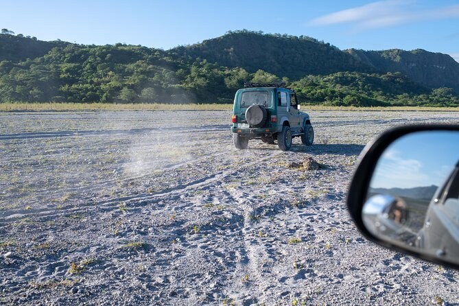
Manila: Mount Pinatubo 4X4 & Hiking Trip
Transport includedMountain fees coveredLicensed guide
From $101 per person
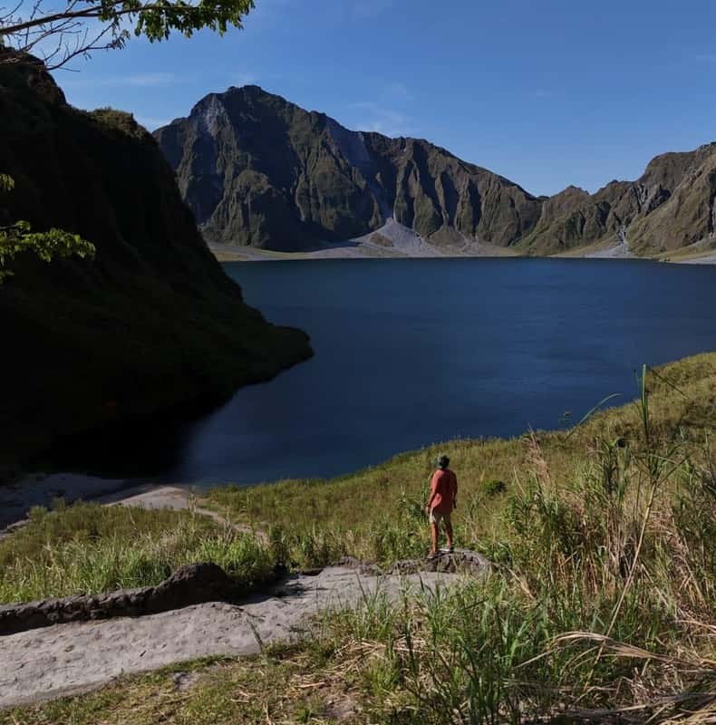
The thing at the end of the walk is a lake that did not exist before September 1991. It fills the hole left when the top of the mountain collapsed, it covers 1.83 square kilometres, and its surface sits at about 900 metres — almost 600 metres below the point the summit used to reach. Standing on the shore, you are inside the volcano.
The caldera is about 2.5 kilometres across, and its walls are the inside of the old mountain: banded grey ash, pale pumice and slabs of rock, with green returning up the gentler slopes. The water changes colour through the day and through the year, from a hard turquoise in strong sun to a flat slate blue under cloud. There is a low path along part of the rim, a stone wall above the shore, and a beach of grey sand where the jeeps' passengers eat lunch.
The climactic eruption on 15 June 1991 emptied the magma chamber and the summit fell into the space. Central Luzon is wet, and by early September that year — less than three months later — a shallow lake had already collected in the new bowl. It went on rising for a decade. What began as a small, hot, strongly acidic pond became a large body of water at close to ambient temperature.
The lake is younger than most of the people who walk in to see it.
| When | What happened |
|---|---|
| Before June 1991 | A forested summit at 1,745 metres, no lake and no caldera |
| 15 June 1991 | The summit collapses; a caldera 2.5 kilometres across is left |
| Early September 1991 | A shallow, hot, acidic lake has formed in the bowl |
| Through the 1990s | The lake deepens; the water cools and the acidity falls |
| September 2001 | A channel about 5 metres wide is cut through the rim and roughly a quarter of the volume is released |
| Today | A stable lake of 1.83 square kilometres at about 900 metres, walkable to in a morning |
This is the question every visitor asks and it has no settled answer. Published research supports a maximum depth of 95 to 115 metres. A Japanese study from 2005 put it at 600 metres, and that figure is repeated all over the internet because it is the more dramatic one. Both numbers are in the literature and this page is not going to pick between them for you. What is not in dispute: the surface area, 1.83 square kilometres, and the surface elevation, about 900 metres.
By 2001 the lake had risen far enough that engineers were worried about the wall holding it. A sudden breach would have sent water and debris down the valleys onto perhaps 40,000 people. In September that year a channel roughly five metres wide was dug through the crater rim and about a quarter of the lake's volume was let out under control. It worked, and the notch is still there — a deliberate gap in an otherwise closed bowl.
The colour is a product of what is dissolved in it and what is suspended in it. In the first years after the eruption the lake was hot and heavily acidic, fed by gas coming up through the floor. As that cooled and the chemistry neutralised, the water settled into the blue-green it shows now. Fine mineral particles in suspension scatter light, which is why the same lake photographs turquoise on a bright morning and grey-blue two hours later.
The rim path: the trail arrives at the top of the wall, where a timber
sign and a low stone wall mark the viewpoint.
The descent: an optional drop of about 250 metres from the rim down to
the water, and back up again, which one reviewer describes as the only real climbing on
the day.
The shore: grey sand, boulders and shade you have to find rather than
expect.
What people do: eat, photograph, sit. That is the whole programme, and it
is enough.
Not on any of the tours here, and it is not something to build a day around. The water was dangerous when it formed and is not now, but access to the lake surface is controlled on the ground and the rules have changed more than once over the years. Take the walk for the view and treat anything else as a bonus your guide may or may not offer.
Between one and one and a half hours, on every itinerary that publishes a figure. The shared 4x4 day allows an hour and a half from arrival to the start of the descent; the private crater hike allows an hour; the other shared listing counts six hours at Mount Pinatubo across the whole stop, which includes the jeep run and both walks. It is a short reward for a long day, and everybody who does it says the same thing. What the day involves sets out the timings and the eruption that made this hole explains the walls you will be looking at. Every departure that reaches the water is on Mount Pinatubo Tours.
From $101 per person
From $382 per person
From $107 per person