Manila: Mount Pinatubo 4X4 & Hiking Trip
Transport includedMountain fees coveredLicensed guide
From $101 per person
Most write-ups treat the approach as travel time and the crater as the destination. It is more interesting than that: you pass through four separate landscapes on the way in, and none of them existed in this form before June 1991.
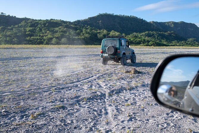
From the registration desk the jeeps run west across a broad flat valley of grey volcanic sand. This is pyroclastic material and lahar deposit — the mountain's own summit, redistributed. It is wide, pale and completely open, with no shade at any point, and it is the reason the day starts before dawn. Only the accredited fleet is permitted to drive it, which is why nobody arrives here in a hire car.
An hour or more of this passes before anyone walks. Travellers write about the jeep run more often than they write about the lake, in praise and in complaint: it is long, it is rough, and it goes through water.
The jeeps stop where the riverbed narrows and the walls close in. From here the trail follows the bed itself between banked cliffs of ash and pumice, cut vertically by ten wet seasons of rain. The ground is boulders and gravel and the route crosses running water several times. How far up the jeeps get depends entirely on the season, which is why the same walk is quoted anywhere between three and five kilometres.
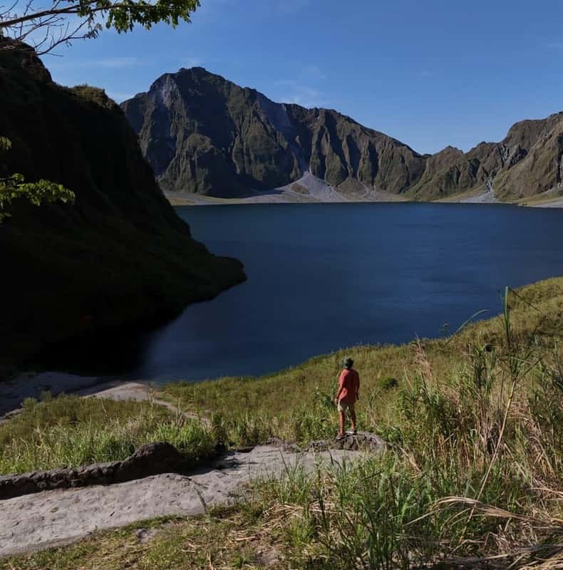
The arrival is abrupt. One moment you are between grey walls and the next the ground falls away and there is water below you. A timber sign and a low stone wall mark the viewpoint at the top. This is the edge of a caldera 2.5 kilometres across, formed when the summit collapsed into the emptied magma chamber on the afternoon of 15 June 1991.
Look along the rim and there is a gap in it. In September 2001 a channel roughly five metres wide was dug through the crater wall and about a quarter of the lake's volume was released under control. The lake had risen far enough that a sudden breach threatened perhaps 40,000 people in the valleys below. It is the only part of this landscape that was made deliberately.
Every itinerary quotes one to two hours and every reviewer quotes a distance between three and five kilometres, and both are right. The variable is how far up the riverbed the jeeps can drive on the day. In the driest months they push well past the usual stopping point and the walk shortens to something close to an hour; after heavy rain they stop lower, the crossings deepen and the same trail becomes noticeably longer. Nothing about the route changes. The starting line does.
From the rim there is an optional descent of about 250 metres to the water and back up again, and one traveller describes it as the only real climbing on the day. The shore is grey sand and boulders. People eat there, photograph, and sit. That is the whole programme.
Five parts, and only the last one appears in the photographs.
| Part of the route | What it is | How long | What decides it |
|---|---|---|---|
| The ash plain | Lahar and pyroclastic deposit, driven by 4x4 | 1–3 hours | How far the jeeps can get |
| The riverbed canyon | Boulder bed between banked ash walls, on foot | 1–2 hours each way | Season and water level |
| The rim | The edge of a 2.5 km caldera | Minutes | Where the trail arrives |
| The descent | About 250 metres down to the water | Optional | Your legs and the guide's clock |
| The shore | Grey sand at about 900 metres | 1–1.5 hours | Which day you booked |
It covers 1.83 square kilometres and sits at about 900 metres. A shallow lake had formed by early September 1991, within three months of the eruption, and it went on rising for a decade. What began hot and strongly acidic has cooled and neutralised, which is why the colour has changed over the years and why the reported depth is a mess. Published research supports 95 to 115 metres; a 2005 study claimed 600, and that is the number the internet repeats. The crater lake page lays out both.
Standing on the rim it is worth knowing that this is not an explosion crater. On the afternoon of 15 June 1991 the eruption emptied the magma chamber beneath the mountain faster than it could be refilled, and the summit — 260 metres of it — fell into the space. What you are looking down into is a collapse feature, which is why the walls are so steep and so raw and why the floor is so flat.
That also explains the material underfoot on the way in. More than ten cubic kilometres of rock and ash left the mountain that day, and pyroclastic deposits up to 200 metres thick filled the valleys around it. Every grey surface between the jump-off and the rim is that deposit, moved downhill again by rain.
The water is not one colour and never has been. In the first years it was hot and strongly acidic, fed by gas rising through the floor of the new crater, and it looked it. As the system cooled and the chemistry neutralised, the lake settled into the blue-green it shows now. Fine mineral particles still in suspension scatter light, which is why the same water photographs hard turquoise under a bright morning sun and flat slate under cloud two hours later.
If you arrive on a still morning you get the other version: the far wall reflected whole in the surface, which is the photograph everybody is really there for. It needs no wind and it does not last, so take it when you arrive rather than on the way out.
Which is a short list, and none of it is a disappointment once you have stood on the rim. If you would rather see all four landscapes than read about them, None departures run through the dry season and what the day involves has the practical side.
Read the walls on the way up and the walk stops being the boring part. Every departure is on Mount Pinatubo Tours.
From $101 per person
From $382 per person